Wednesday, May 29, 2013

Yellowstone and the Grand Tetons


Many Americans love Yellowstone National Park even if they have never been there. I’ve been privileged to visit it twice, but the nearby Grand Teton National Park had a much greater impact on me.

Grand Teton for the first (and second) time

I had decided to base myself for a week in Idaho Falls. There were a number of reasons, but the main was the RV park I spent a week in was dirt-cheap: $146 for an entire week.

But it was also within a couple of hours of the national parks I wanted to see and Idaho Falls had bits of “civilization” such as McDonald’s, Wal-Mart and all the other exploiters of child and senior labor which make our lives so interesting.

The road at the entrance to the RV park was called “Yellowstone Road” and the people who named it that had a lot of gall as Yellowstone was well over 100 miles away. But it was also a direct route to Grand Teton. I decided that, even though Yellowstone was just 20 miles further on, that I would give it a day to explore.

About 40 miles out was a rest stop along the Snake River. I had passed along the river in many places in both Idaho and Oregon. It is the location of much of the Oregon Trail, something that as a historian, I have been interested in as I have been along much of it. At some places, the river was shallow and one could cross it on foot. Yet a few miles away, where the bed had narrowed, it became violent and dangerous. Here, was a lovely landscape showing the river in a small canyon.
The Snake River about 40 miles north of Idaho Falls, ID


Moving on, the road went deep into Idaho farmland and then through narrow, winding roads in Targee National Forest. I had been here before and I had no idea what I would see. And that was part of the wonderful surprises of the journey. As with all journeys, getting there is just as important as the arrival.

Targee offered plenty of beautiful views, especially of Pine Creek, which meandered through the forest. I had a close encounter with a semi-suicidal elk, which just didn’t want to get off the road as cars were coming from each direction and the panicked animal just didn’t know which way to turn, especially when the damn fool behind me started honking his horn.  The animal kind of reminded me of myself at times, having to make a decision, but not knowing what to do, but having to make one anyhow.
Targee National Forest offered a pleasant ride as I headed to the Grand Tetons.

There were many, many winding mountain roads with sharp turns and low speed limits. It was fine on the drive out, but very scary on the way back. I have recently been afraid of heights. It started last July in the South Dakota Badlands when I realized there was nothing to stop me from falling hundreds of feet. It takes a lot for me to stop and take a picture in these situations no matter how beautiful the scene is.

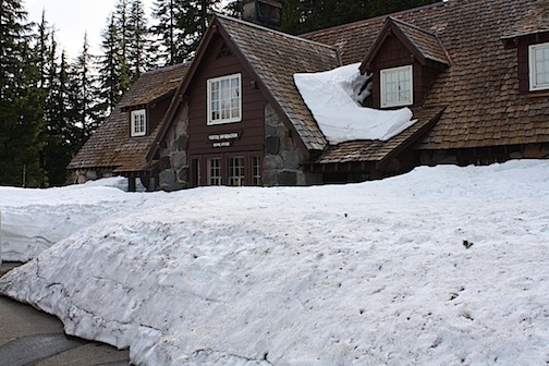
But at the top of one mountain there was a turn off. Far below was Jackson Hole. A sign told me that and it was next to a snow filled mountain. The thermometer was at 31 degrees. It was certainly not the type of weather I expected just before the Memorial Day weekend.  Take a close look at the sign. That is snow there.
Top: Jackson Hole, the huge valley where Yellowstone and the Grand Teton parks are located. Bottom: The welcome sign, Note this is taken on Memorial Day weekend and there is snow in the grooves. It is on a mountain with several feet of snow.


One has to understand the difference between Jackson and Jackson Hole. Jackson is a small town devoted mainly to tourism, as the entrances to both Grand Teton and Yellowstone are only a few miles away. Jackson Hole is a geographic term that describes a huge valley in which the parks lie.

Anyhow, I slowly descended along the mountain curves into the “Hole,” passing through a small town called Wilson before reaching Jackson. Jackson has a visitor center where one can purchase any number of high-priced souvenirs related to the parks, and I indulged myself in picking some patches. I have to start a new patch sweatshirt, as the one I have is full. I actually purchased some Yellowstone Tees at the Wal-Mart in Bozeman Montana. Anyhow, it is adjacent to a stream and a wildlife viewing area. I don’t especially like Canadian Geese as the crap all over wherever they settle and this was true of the visitor center. But I forgave them this once because they had recently-hatched goslings who were simply adorable. The ducks were kind of cool. There was a mallard swimming side by side with a wood duck. They were fishing together. It reminded me of my friend Bill. We are completely different yet remain strong friends over decades.


I proceeded on to the park. It was stormy in the mountains and I had some really dramatic photos. I stopped at the Park’s visitor center to see the exhibits and make a deal with the rangers. I showed them my “volunteer” pass and explained that my “home” park in Oregon has a wall filled with junior ranger badges and I would like to trade one of our’s for one of theirs. I guess my home park is just about the only one with a display like that because the rangers simply give me the badge rather than trade.

While there, I saw a live radar picture of the mountains and while the storm was increasing in intensity (I could hear thunder) it was moving fast and would probably be over in about an hour.

A couple of facts about the park might be in order at this time. The park runs along one side of the mountain range. A series of lakes separate the mountains from the visitors and climbing by the typical tourist is not available.

At the same time, it is a place to simply slow down. Take a drive along the range and stop at many areas. Just sit there and perhaps picnic or walk a trail (though it annoyed me that Pup wasn’t permitted on the trails – what difference is there between bear, deer, moose, elk and other crap and the small droppings of my poor corgi?).
Top: Mountains when clear. Bottom, during a thunderstorm


I stopped at a picnic area by Jenny Lake and took some photos, at the same time trying to outwait the storm. I really didn’t mind the rain at all. It was refreshing and I was refreshed by the wonderful view. My friend the professor says it is his favorite place on the planet and I can pretty much put it in my top ten.

As I continued to wend my way along the park road, the clouds began to clear and I got a few more beautiful pictures. At the same time, I did a lot of thinking about life in general. The ex had gotten re-married the day before and I thought about how we had once wanted to travel through this area. But it was not to be. I hope she has the chance to do so with her new husband. It is well worth the trip. But that too made me aware of my solitude. It is something I expect to live with, but hope that my eventual return east in the autumn will change that situation. But I have been gone for a year and then will be a time to evaluate things. I sometimes think of the Simon & Garfunkel verse: “I am a rock. I am an island. And a rock feels no pain. And an island never cries.” It’s nice to claim at times, but completely unrealistic. This year’s holiday season was absolute misery.

Lake Jenny, just a place of peace with incredibly clear waters.

Because of the weather, the park was pretty much empty. But somehow, it gave me comfort. For all its majesty, it was still rocks and islands.

Two days later, I returned to the park while en-route to Yellowstone. I simply wanted to grab a few photos on a much clearer day. It was well worth it as it gave me much peace.

Yellowstone a second time around

Timing is everything.

I visited Yellowstone National Park last July en route to Oregon. I hadn’t a clue about the park and thought it was, at most, 50 miles away. I had camped near Bozeman, Montana a couple of exits west of the Yellowstone exit on Interstate 90. Little did I know that it was 100 miles more to be inside the park. Then, my agenda was simple. I wanted to see Old Faithful, the geyser that erupts about ever hour and ten minutes. That would take me almost two hours longer.

Then, I had left Bozeman around noon and didn’t reach the geyser until around 5 p.m. I had to wait an hour for its eruption and spent time at the souvenir shop. So following the eruption, I had little real time to explore the park. I left the area somewhat disappointed. I had hoped to return the next day, but was exhausted from all the driving I had done in the non-stop haul from the South Dakota Badlands to Bozeman.

And so, I proceeded on to Oregon.

But this time, the return trip was different. My Idaho Falls locale is about 100 miles from the West Entrance. After taking my first day in Idaho Falls to explore Grand Teton, headed out around 6:30 a.m. to Yellowstone, relaxed, refreshed and ready to explore.


A general rule for tourists is if you take their picture, they will take your's. Courtesy of one of the many Japanese tourists I encountered.

To get to either park, you have to take the same mountain roads through Targee National Forest. So I enjoyed a repeat of the beautiful views. After my stop at Grand Teton, I moved on to Yellowstone, arriving around 10 a.m. Like my first visit to Yellowstone, I had an agenda – to see the magnificent canyon and waterfalls in the park. Ironically, I had to go to the Old Faithful area to reach the Grand Loop Road, which went through the park with many of the major sites.

So I stopped at the Ranger Visitor Center and again traded Junior Ranger Badges. I hope to have around a dozen before the end of the year to send to my “home” park in Oregon.

And the timing was right as Old Faithful was scheduled to erupt in about 20 minutes. The last time, I waited nearly an hour. There are many places around Old Faithful to buy stuff. But I used the non-profit store to get a DVD for myself and a Yellowstone “ranger" hat for my granddaughter, part of her Christmas parcel.
Old Faithful erupts

I ventured over to the geyser, and waited. I noticed something odd. I was surrounded by Japanese tourists. Throughout the day, about half the people I encountered were Japanese. I had worked for several Japanese companies over the years and I recognized a little of what they were speaking. Apparently several tour buses were here, as well as rental cars. Later in the day, one had run off the road and had to be hauled out and towed away.  It seemed impossible to go off the straight road where they were, but I also had several close calls as the many scenes distracted me.

From Old Faithful, I began the loop and stopped at many geysers. Many of them could be seen fairly close as we walked along boardwalks more than a mile long.
It was difficult to take photos as the air was cool, in the low 40s, and the vapor from they geysers blocked views. But the colors of the pools were extraordinary. Topaz, sapphire, emerald and more were vividly deep, as the absolutely clear but boiling water had reacted with the minerals in the ground underneath.


The many colors produced by the reaction of the waters with the minerals are visualized by clear water

I went to several of these sites, enjoying each of them. At one point, the steam was so great that the visibility was zero and the smell was disorienting. I had to frequently stop until the vapors cleared, afraid I might trip and fall into the turbulent waters.
The eruptions can turn the observation boardwalks into fog.

Moving on, I went through a few meadows. I had been apprehensive that Pup might go a little crazy as I remember a description by Steinbeck in “Travels With Charlie” as Steinbeck’s normally placid poodle had to be locked in the camper and tore it apart when it smelled bear.  In both visits to Yellowstone I did not encounter bear. There were deer and elk, and a herd of bison and pup had no reaction. But we passed by a lone coyote and as I stopped to take a photo, Pup let out a sharp, alpha-male bark that was about as loud as I have ever heard from him. The coyote went on his way and I didn’t get the shot.
I saw plenty of Bison but failed to see Yellowstone's famous bears for a second time.

We finally started reaching the falls. I know the lower falls is the largest, but from the parking area, the hike is nearly a mile each way on rough terrain. I just wasn’t up to it after several miles of geyser hikes.

And so I moved on to the upper falls. I was entirely unprepared for this. To reach them, you had to move along Yellowstone’s “Grand Canyon.” Now I’ve flown over the real Grand Canyon many times, but have never been there. From my Yellowstone experience, I would probably just as well take it or leave it. The Yellowstone Canyon is magnificent and incredibly deep as the Yellowstone River wends its way through it. There was little in the way of barriers to prevent one from falling hundreds of feet to their death other than small boulders about knee high. I got my photos, but told myself that what I would do for my “art” could be downright stupid.
The incredible Yellowstone Grand Canyon, All that was between me an the river when I took this photo was a two-foot rock.


There is a place in Sullivan County, NY along the Delaware River called the hawk’s nest. It is a road with many winding cliff-side curves that is frequently used for automobile commercials. I took my friend Emily to the overlook there and she was very scared. I couldn’t understand it then. But now I do. As I think of that place, it too was very deep. Multiply that by a factor of 20 and I have had enough Rocky Mountain Highs to last the rest of my life, thank you very much!

I drove past some other waterfalls and cascades but the next really impressive thing was Lake Yellowstone. It is immense. When you consider the Great Lakes border Canada, this is the largest lake in the continental United States. With mountain backgrounds, it is something of beauty that one can only understand by visiting there. Photographs only give you a minute perspective. It is, in my opinion, the only thing of beauty I have ever photographed that I couldn’t capture adequately.
Waterfalls, such as the Keppler Cascades, are abundant.

Throughout the park are many dead trees surrounded by thriving smaller ones. I thought they had been killed by disease, as there was no charcoal black on them. But more than 1/4th of the park was destroyed by fire in 1988 and I suppose the blackened part has simply washed away over the decades since.

It, too, is a thing of beauty in some respects. The trees that have risen from the ashes could only have been grown from the pinecones that require fire to burst open seeds. The dead trees are filled with insects that birds prey on. It is a brutal exchange of nature, which can often be unforgiving.

I left the park around 6 p.m., hoping to get out of the mountains before darkness. But I chose to stop for dinner in Jackson rather than open up the can of stew I had brought with me. And as I went into the mountains, I encountered any number of suicidal deer in the Forest.

But there was a full moon and as I finished my mountain crossing I saw this image. It is a little blurry since such a long exposure time was required and the camera shook.

A full moon near the mountains watched over me on the way back to my campground.

I made it home alive and spent the next two days recovering from my two trips.
My memories of the two parks will remain in my heart for a lifetime. I don’t know if or when I will return to the West, but you can be sure that if I do, I will continue to drink in the wonder.

Tuesday, May 28, 2013

Journey through Idaho


(The Professor is a name I gave to a friend who shall remain a mystery, because he is.)

Dear Prof:

Heading along Route 84, I passed from Oregon into Boise, Idaho and quite honestly was not impressed. It’s a nice town, I’m sure but it reminded me of New Jersey in a desert.. I had seen enough wastelands through central and eastern Oregon but the only thing I found remotely attractive was the Snake River at the welcome center, and that was photographing the Oregon Side.

It was my first time “feet down” in Idaho. Unless you counted a step over the “Welcome to Idaho” sign along I-90 I passed on my way out to the Coast, I hadn’t stopped in the state as I crossed the panhandle. It was beautiful country, especially the lake at Coeur D’Alene, but I was so hell bent or reaching Oregon that day, I wouldn’t stop.

Like I said, I was not impressed by Boise, but to be honest, I didn’t give it much of a chance. I just viewed it from the Interstate, a maze of seemingly endless retail operators mixed with tumbleweeds blowing across the highway.  If one hadn’t just been driving from Oregon, perhaps the wastelands would have been more attractive for their beauty, but there is nothing beautiful when viewed from a big box retailer or car dealership.

I was also finding it difficult to drive their was a fierce wind blasting from the east and forcing my gas mileage down from about 11 mpg the day before to 6 mpg as I had head-on winds pushing on both the truck and the trailer. I was not very happy about this. Another issue was the speed limit. They let people drive 75 mph out here! I wouldn’t even attempt it. I haven’t a clue what the accident rates are here, but it was like being trapped between choices of going to fast or creating issues by going the 55 mph I wanted to. Drivers were constantly passing me and blasting their horns in outrage.

And so I decided to take a back road – Route 20 – up to Idaho Falls where I am staying through Memorial Day Weekend. It is an inexpensive and unassuming RV park, about $20 per day with few amenities. But It’s seemingly safe enough and a good base camp as I explore the nearby Grand Teton and Yellowstone National Parks.

I did see Yellowstone about a year ago, but was only there for an afternoon. I managed to see Old Faithful. But I missed a lot. This time, I have five days to explore. And at around $3.50 per gallon, gas is cheap enough to do so.

But back to Route 20. Most of the route was pretty much my own, though speeds of 65 mph are permitted on this two-land road through the wilderness. I was much fretted as I began hauling the trailer up the hills. Although I had just filled up, I was down to 5 mpg and was quite concerned if I would reach another gas station. There was a sign on the road near the station where I filled up that read “next service, 155 miles.” Even with a 25-gallon tank, at 5 mpg, I would be short by 30 miles.

But when I was in the hills for about an hour, there was a place to pull over that marked an incredible view. I could look back and see the road I had driven through the magnificent green hills. There were snow-capped mountain peaks in the far background. This was somewhere near a place called Hill City and while I saw many hills, I saw no signs of a town either. But out in the valley, I saw a red ranch house and couldn’t help but wonder what it would be like to live there. The scenery was too beautiful to describe, but so was the isolation. I couldn’t begin to imagine what winter would bring.
Top: Rural Route 20 in Idaho. Incredibly beautiful, and desolate, I wondered who would build a ranch here, and I'm jealous. Bottom: From the same vista, the road I had just climbed.


Where one must drive up mountains, there is also a place where one drives down them. It was only a mile later that moved on to Sun Valley and the Snake River Plains. Mileage would eventually rise to 10 mpg, which is normal for towing. I gradually watched the “miles to empty” display on my dashboard exceed the “miles to go” on my gps unit. I really liked a place called Soldier Mountain. On the mountain is a ski resort, but I chose to simply pull over and enjoy the view from my route.


A bit further on was the Craters of the Moon National Monument and Preserve. I had heard of this locale since childhood. It is the location of a sea of lava fields from a 52-mile long tear in the earth’s crust. This lava is frequently quite jagged, unlike the well-worn cliffs of the Columbia Gorge. It was rather interesting; though I had seen so much volcanic rock over the past year I have to admit to having a “So What?” attitude. It’s pretty in it’s own way, but after seeing places such as the Dakota Badlands, Yellowstone, the Everglades and more, it just seems kind of minor league.
The Craters of the Moon are miles and miles of volcanic rock with just a bit of vegetation to decorate them


As you may be aware, most of my return trip to date has been following the Oregon Trail, only in reverse. I had become very acquainted with The Dalles. The Dalles is the town where the Oregon Trail ended. To get to the Willamette Valley, pioneers had a choice of risking the raging river with rapids and waterfalls, or heading into the mountains and risk an early blizzard. What I have learned from this experience is an incredible perspective of just how tough the journey was. I took my time from the Midwest and reached Oregon in about 10 days. But these brave and foolish souls had to travel, mostly by foot, over endless and rugged terrain. I cannot help but think that as they witnessed the vast wastelands, they wondered if there really was a promised land waiting at the end of the journey.

I passed near Butte and saw the immense rocks that were landmarks that gave the pioneers hope. There were two similar peaks near a place called “Atomic City” which is where the Idaho National Laboratories are located. From a distance, one can see that one peak is extremely dark while the one next to it is extremely light. As you got closer, the difference wasn’t as radical, but along the route one could fantasize about what the scientist had done to the lighter (or darker) one. I suspect that the Lab’s location is so remote because it wouldn’t do to have an experiment accidently blow up. I can’t help but contrast it with the Brookhaven National Labs on densely populated Long Island and speculate on what kind of terrors were created.
Twin peaks near Atomic City, home of the Idaho National Laboratory. From a distance, the difference in color is startling, but not so much when viewed from a closer place.

Anyhow, at that point, Rout 20 merged with Rout 26 and suddenly I found myself in fairly heavy traffic. I decided that since I only had about 30 miles to my destination, to go at the speed limit to avoid creating my own personal traffic jam. And so as I finish writing this, I am proceeding on. Today, the Grand Tetons, tomorrow the world.

Closing Night


 When I was a high school freshman, I participated in a musical tribute to Broadway called “Take Time Out.” An outside producer named Joseph Hayes directed the show. A few months later his first play, “A Shot In The Dark,” debuted on Broadway. It introduced the world to the bungling Inspector Closseau character immortalized by Peter Sellers. I suspect after that Mr. Hayes didn’t do too many more shows with high school kids. But I was one of those privileged to do so.

I had never been in a show before and on opening night as we were standing behind the curtain waiting to belt out “Another Opening, Another Show” from Annie Get Your Gun, I was in panic mode. The girl next to me, a gorgeous blond cheerleader, put her arms around me and whispered in my ear “we can do this.” I was so distracted that when the curtain opened, I was ready to rock it!

Anyhow, something happened after that opening number, people applauded – wildly! And it was like mainlining heroin. I was hooked. I decided I would become an actor.

I landed a few roles in various high school plays and took the only drama class the school offered. And I learned the basics. But after graduation, I auditioned with a local theater group and realized I had nothing to offer. My training was non-existent. My skills were minimal and my talent even more so. Fortunately, a few years later I discovered my true muse, writing.  And so the world lost a lousy actor and gained a mediocre writer. Hey! It paid the bills.

But I have had the opportunity now and then to work with the performing arts. Mimicking Mr. Hayes style, I worked with day campers for their camp shows. And as a teacher, I’ve found that certain lessons can start in the morning and by the time I reach the last of the day, I am so well rehearsed that the lesson goes smoothly.

But one of the things I’ve been able to do while volunteering at state parks in Oregon was to put some pizzazz into interpretive presentations. While at Fort Stevens state park, I gave tours of the ruins of the fort from the back of an old army “duce-and-a-half” truck for a month. My driver would play a tape and then I would supplement what was on the tape with added information. Two weeks and about 30 tours later, the tape deck crashed and I told Sam, the driver, that I would do it all. He had never heard me because the tape was so noisy and was amazed to hear me give the riders a well-rehearsed, 45-minute monologue.
Sam Yanni, left, and I gave tours on a 1954 Army "Duce-And-A-Half" troop carrier truck last August in Ft. Stevens, OR. Sam is a deeply spiritual man who has had several bouts with MS. He fought back each time believing God still wanted him to do something. He was unable to return to Ft. Stevens this year due to his illness and I haven't been able to contact him. He loved living in the outdoors as a camp host rather than being tied to an apartment with his illness.. 


But the best part has been at Memaloose State Park. Last year, the evening campfire programs were supposed to end at Labor Day and I asked to do a program about the Columbia River on the last night. The ranger let me “do my thing” and I wound up developing a series of programs for visitors then and in the early part of this year’s season. They are quite happy with this because the ranger who ran the program last year has moved to a different park and they are now having volunteers do the programs. I’ve been able to create six of them, enough for a month, so volunteers just have to push a “play” button.

Last night was my last night of doing these presentations. I am moving on from Oregon, heading back east to see if I can find an old or new home for myself there. I didn’t think much about it other than saying to myself “hey, this is the last time.”

I had selected my favorite program to end the run. It is about the Oregon Trail. After a get-acquainted time, I tell the people how the nearby town of The Dalles (the word “the” is part of the town’s name) was where a life-and-death decision had to be made. To get to the Willamette Valley, pioneers had to either go down the raging Columbia River or go overland near Mt. Hood and chance early blizzards.

I told them this choice reminded me of a question a philosophy professor once asked. If you were sentenced to death, would you prefer to be burned at the stake of beheaded? Of course the entire audience says they want the beheading and I tell them “Not me. I’ll take a hot steak over a cold chop any day,” Amidst the howls of outrage and laughter, I settle down and we do a sing-a-long song from a 1950s movie about the Oregon Trail. The music plays and after the song, the video tape continues to a short slide show I’ve made about the Oregon Trail, comparing my travels along much of the trail to what the pioneers did (“They had no firewood and cooked their meals on buffalo chips. Me? I had propane!”). This was followed by a half-hour movie and closing salutations.

It, too, had been done many times over the past two seasons, and I was very well rehearsed. It went very smoothly. I remembered all my “lines” and my audience left feeling happy. Many stayed to talk to me.

After that, I realized I had to pick up some milk and as I drove into town, I experienced a feeling I’m sure many actors feel. This was a long-running program. It wasn’t the three or four shows done in high school. And I experienced a feeling of satisfaction. I gave it my best each night of the run and it kept getting better. People enjoyed it.

Somewhere along the road of my life, I heard that campfires warm you twice. Once when you are at them and again when you remember them. I know I left behind a great deal of people warm. And I realized that it wasn’t about me, or my acting, but that it was a privilege to serve them.

And so my run in Oregon parks has ended. It’s been a wonderful time and thank you very much, uh-huh!

***
Note: It didn't stop when I left Oregon. At my next destination, Wall Drug, a tourist trap in South Dakota, I spent two summers selling snake oil (not that YOU need it, but it will even make you more attractive to the opposite sex. And it will also clean your rusty shotgun) as well ad deputizing all the kids who bought toy guns. after all, I was the sheriff and South Dakota's strict toy gun laws had to be enforced.

Leaving Lydia


Over the past few years, I’ve referred to my granddaughter, Lydia, as “the world’s most beautiful and brilliant toddler.” As you can see from her picture, I am absolutely correct about the beautiful part. To meet her is to understand the brilliant part.

But alas, I do not think the next time I see her, I will be able to call her that. She is about to graduate from “toddler” to something else, perhaps “big girl?” There were two reasons I left a superb support system in the East to visit Oregon: to see this precious (and precocious) child; and to hopefully establish a better relationship with my son following a bitter divorce with his mother.

The first time we again met was last summer and the relationship with each was strained at that time. With my son, it was re-establishing a trust and caring relationship and with Lydia, it was a matter of getting acquainted. Our average time together was usually one day per month over the 11-months I was here.  I had not planned to spend so much time here, but it was time well spent. I was able to explore much of the wonderful beauty of the Northwest, and shared some things with my son’s family. There was a first time at the beach, visits to the Columbia Gorge, and trips around Portland. And on May 17 was a wonderful last day with them. We took a rail trip through the Hood River Valley via the Hood River Railroad (Lydia is crazy about trains) followed by a visit to Rowena Overlook, one of the most beautiful places in the world and yet another cookout at Grandpa’s campsite with toasting of marshmallows.

And this last day together for a while was the best. Lydia was genuinely affectionate. She no longer was wondering who this man was. And my son and I seemed to be bonding closer than I ever anticipated. I told him a few things about my personal life and was overjoyed by his reaction.

And so, the day ended with loving hugs. I am a year older now and I am not very happy about my health. I don’t know if I could do the park host thing again, at least not without a partner. And while there is much joy in seeing America’s wonders, it is time to share that joy. Which is why I am heading back east.

Oregon has been a wonderful experience for me. The people I have worked with at both the state and national parks have given me great support and permitted me to use the talents God has given me in a positive manner. And for a hard driving New Yorker in a laid-back culture, that has taken some getting used to. There have been some lessons learned by me as well. My mania isn’t all it’s cracked up to be and I’ve started taking much better care of myself.

The next stop is Yellowstone, Grand Teton and other things I can find before settling in at the Badlands to work retail for the summer at a well-known tourist destination.  This will be the first time I will work in more than five years. I hope I have recovered enough to be able to handle working full time for a while, as it is a time when I need to improve my finances. I know I couldn’t do this for more than the summer months but volunteering for about 30 hours a week has given me hope.

And then I hope to return to the NYC metro area in October and renew a relationship with the other son in my life. His brother tells me he senses a great deal of maturing as he is helping his best friend through the trials of fatherhood. Perhaps he will understand me a little better?

Over the past few years, people have asked me where I live and I have come to point to my trailer and say “home is where I park it.” I even have a tee shirt that states that fact. But I sometimes feel awash in a sea of America The Beautiful. I am often reminded of a verse Neil Diamond once wrote: “LA’s fine but it ain’t home, New York’s home, but it ain’t mine no more.”

I suppose most of my life has been a quest for a home. Born in New York City, my parents moved to New Jersey when I was five. They separated two years later and my life became a living hell for three years as I lived in 11 different places and attended five different schools before crashing and winding up in a home for boys for four years trying to get myself straightened out.

The first two days after I went on the road, I visited that house in NJ where I thought I would grow up with two parents and the home for boys. At both places I learned the difference between perception and reality – and they were wide gaps. One person, actually two people, said I had to journey to “Munzerville” to figure it out.

My wanderlust lifestyle was something I was seemingly never able to share with the ex. And yet she gave me an anchor. We lived more than seven years in Queens and then nearly three decades on Long Island. I never seemed to be content with that anchor. The inner demons wouldn’t let me forego the constant childhood fears completely.

And after this day that ended with a flood of warm hugs, perhaps it isn’t where I am that’s important, but rather where I’m at.

As a kid, my favorite television show was “Roy Rogers.” I’d like end this thousand-word whatever by sharing the lyrics that ended the show with all those whom I love and am privileged to be loved by:

Happy trails to you
Until we meet again.
Happy trails to you
Keep smiling until then
Happy trails to you.


Tuesday, May 14, 2013

Crater Lake and the High Desert


Written April 30, 2013 but not posted until today since I've been off line.

 Most people who know me realize that I absolutely hate snow.  I spent winters in 2010, 2011 and 2012 in Florida, avoiding some tremendous blizzards and extended periods of sub-freezing weather that typified the New York Metro area where I spent most of my life. I spent this winter along the Oregon Coast and the six storms exceeding 90 miles per hour were just fine with me. The only time I saw snow was a trip across the coastal mountain range and it was about an inch or so. And that was more than just fine with me.

So was it worth driving a 555.5-mile round trip over 13 hours to spend a half hour standing in snow over my head? OH YEAH!

It is late April and I am now headquartered along the Columbia River Gorge. We’ve now had any number of days where the temperature has reach the 70s and we even had two 80-degree days over the weekend.  I’ve been in Oregon for 10 months and I will be leaving the state in about three weeks as I head to a summer workamping in South Dakota before returning to the NYC area for a time.

The only place on my Oregon "bucket list" I hadn’t visited yet was to visit was Crater Lake National Park, a distance of about 275 miles away. The lake is featured on the state’s quarter and that alone made me want to see it. But Oregon is one state that is more about geology than any I have ever visited. Balsamic Rock forms most of the Columbia River Gorge from prehistoric lava eruptions. Mighty Ice Age floods tore through and tore out the Gorge and emptied into the entire Willamette Valley bringing incredibly fertile land and leaving large parts of Washington State barren.

The Ocean is littered with incredibly huge boulders from the Coastal Mountain Range and, of course, Mount Hood dominates the Cascade Range.

But Crater Lake is unique in the entire world. It rests on the remains of a 12,000-foot tall volcano that collapsed when it exploded about 8,000 years ago. Scientists believe the eruption may have been the largest in North America in the past 640,000 years.

What remains is a lake that exists solely as the result of melting snowfall. There are no rivers or streams feeding it and there is no aquatic life. It is considered the cleanest and clearest large body of water in the world.

Though dormant at this time, it is still a volcano. It has started to rebuild itself and there is a large island formed by a new cinder cone.  It is immense, six miles wide and nearly 2,000 feet deep.

Even at the time I visited – two days before May – the snow is nearly triple my height at 15 feet deep in some places. Most of the park is closed until late May, when there is still more than three feet of snow on the ground.

As with most of my travels, the journey is just as good, if not better, than the destination. As I woke up, I started saying “road trip” to Pup, the corgi who gives love without judging and sheds hair without ceasing. When I utter those words, he gets real excited and prances throughout the trailer until it is time to leave.  So I packed some lunch, dinner, water, and dog food. Of course, empty plastic bags are a must for Pup’s end product.

Pup watched the packing ritual with even greater excitement. He seems to know my ways and knows it is time for adventure. We have a ritual where I open the door, step down the stairs and leash him up before heading for the truck. So I draped the leash over my shoulder and opened the door.  WOOSH! He roared out the front door, crossed the street and stood at the driver side door waiting to be admitted. Naturally, the woman who manages not only my park, but also several others along the Gorge, happened to be there at the moment. I was saved because I had the leash wrapped around my neck.

Anyhow, we got off safely and I headed for The Dalles. To gas up No, that is not a typo. The name of the town is “The Dalles.” Early French fur traders named it and it translates roughly into a place of running water. And that it is as it borders the Columbia River. But I was also told that the more common use of the term in that era refers to the open Parisian sewers of that era. So it is unknown what the fur traders really thought of the area.

The Dalles is also the town where the Oregon Trail ended. To get to their ultimate destination in Oregon City, pioneers had to then raft down the rampaging river – one in ten drowned – or risk an early season blizzard by taking the Barlow Road past Mt. Hood.

Leaving The Dalles, I headed southbound along highway 197 and later 97. I entered an area known as High Desert. Here, there is a little agriculture, but not much. In general, the topsoil is very low, if there at all. It is a result of having been swept away by perhaps 100 Ice Age floods where a giant lake in Montana had formed as rivers were blocked by icebergs or glaciers. It was about the size of Lakes Michigan and Erie combined. When the dam broke, the lake drained in about 48 hours, sending a flood hundreds of feet high down the river travelling at about 90 mph. In this area, most of the water headed for the Columbia, but there was so much that a number of other river beds formed. They are now dry.

But it is not very conductive to farming. Most cattle and sheep can’t eat the plants that do grow there. The tumbleweeds outnumber small pine trees by about 50 to 1. But it’s desolation and quiet are simply wonderful. I paused for a bathroom break and happened to look to the west where a fierce wind was raging from the cascades. Pup’s urine was actually flowing horizontally, landing on the tires, which were about 10 feet away. And I beheld a beautiful view of Mt. Hood. You could see a snowstorm approaching the mountain from the north. And it was half in sun and half in clouds. I knew the mountain was about 100 miles away, yet it dominated the horizon. I wondered what it would have been like to try to travel over the land for days to reach what appeared to be so close.


High desert area north of Madras, OR. There is very little agriculture or people in this area, sometimes called the "wastelands."
And so the voyage continued. I stopped at a town called Madras. A small farming community at the crossroads of a couple of highways, it boasted a McDonalds and so lunch was served. I bought Pup a $1 burger for a rare treat. Perhaps that is why he looks so forward to road trips? He likes to eat the top bun, flip it over and eat the bottom bun before attacking the burger, which is perhaps three gulps. I always feed him at the same time as I eat and it seems as if he finishes his meal in scant seconds, then stares at me until    I finish eating, as if the poor mutt was famished.

We proceeded on (The brass filigree with bronze oak leaf cluster to whomever lets me know where that expression came from – same to those who know what I’m talking about regarding the filigree).

Carved into the high desert is a huge valley formed by the Deschutes River. You travel downward along hills with road signs announcing downgrades of five, three and two miles. The valley is lovely. A small town grows there and it is set in a fertile valley. It seems like a place to spend the rest of one’s life.

Valley in the high desert formed by the Deschutes River.

The miles rolled on. Finally, I reached the North Entrance of the park. The entrance was closed. I didn’t know it at the time, but in the winter season only the south entrance is open.

I kept on driving, with every dirt road, the GPS was telling me to turn in. The last time I did this, the GPS said Highway 1 was 100 feet in front of me. Highway 1 turned out to be the Pacific Ocean beach and I got stranded in a dune. It was a lesson I didn’t want to relearn. I came to a rest stop and reprogrammed the unit for the South Entrance. It was another 6o miles.

I proceeded on.

It was starting to get later in the afternoon. The original GPS readout told me that the entrance would be about 250 miles away. It didn’t tell me that I would be going through a number of towns and slow speed zones as well as mountain curves and it was already 3 p.m., my planned arrival time.

As I drove on, I passed a state park with camping facilities. I was much relieved in that I would have a place to pull in and catnap if I needed to.

I finally reached the GPS idea of the entrance. Indeed it was, but the lake was still another 20 miles away. I tuned in to the park’s radio frequency and learned to announcements. I then “officially” learned about the closing of the north entrance and just about every road in the park except for an observation area. The announcements strongly suggested I may want to rent snowshoes which were “fun for the entire family.”

I saw a small area of melting snow, and as I climbed the mountain, it became larger and larger until I was driving past snow twice as high as my pickup. There were tall posts every 20 yards or so on each side of the road. I figured out they were landmarks for snow removal equipment. I learned that the snow isn’t plowed. It’s more than 140 inches deep. Giant snowblowers remove it.

I arrived at 4:45, just before the park facilities closed. I managed to purchase a patch, my souvenir of choice, and trade a junior ranger badge from Lewis & Clark National Historical Park where I worked in the winter for one of theirs. I am collecting them to send to the park as they exhibit badges from all over the nation.


The entrance to the gift shop was so covered with snow, one had to use a snow tunnel to enter at the side of the building. I became very disoriented in the dark until realizing I had left my sunglasses on!

Getting into the gift store was something else. Instead of walking through the main door, I had to go through a snow tunnel. Most of the building was covered with at least six feet of snow. The nearby park offices, on a little higher ground, also required a snow tunnel, as did the only restaurant that was open.

Another five miles took me to Discovery Point, the open observation point. I had to scramble up several feet of snow and I was thigh deep in the wet stuff and beheld the incredible view. I took a number of photos. It is pretty hard to take a bad one with a view like that. I then went back to the truck and grabbed Pup to get a photo of him at the lake. Pup is a great dog. Rescued from Florida, he has the same feelings about snow that I do. The first time I took him out in the snow, he immediately ran under the trailer and no amount of coaxing or doggie treats would get him out until he got cold enough to come to “daddy.” Since then, He’s seen a few snowstorms, but is a good sport.

As I took him out of the truck, he eyed me with some suspicion, but he was a good sport about it. I sometimes thing immense things like the snow all over escape him. I took him on a walk through the California Redwoods and he would mark his spot on many trees, but the redwoods were so immense, he couldn’t comprehend they were trees and left them unyellowed.
Pup just LOVES the snow -- NOT! Taken at Discovery Point, where Crater Lake was first seen by white men. 

But he was a good sport about it and climbed up where I had just crushed the snow and posed for his picture. He was obviously happy to get back into the truck.

It was now dinnertime. The restaurant had closed but I was prepared. Pup had canned food instead of his usual dry food and I mixed some cold leftover rice with an uncooked can of vegetable soup.

It was now about 6:30 p.m. There were still a couple of hours of daylight and twilight left and I had to make a decision about where to spend the night. I wasn’t tired and I decided to “one step” my decision. When I’m on the road, I often select certain places and decide to stay or move on as I reach each. I knew for certain that I didn’t want to stay in the truck at Crater Lake. The temperature was a chilly 39 degrees and I didn’t have anything warmer than a windbreaker.

I proceeded on.

The landmarks I had chosen were the state park, a Pilot gas station (they let truckers and RVers park overnight there if you gas up) and the town of Madras, where we ate lunch.

Although down from the mountains, the temperature at the state park was in the low 50s at twilight. It was dark when I reached the gas station, but I was not yet tired. The McDonalds where I had lunch was closed, as was most of the town and so I continued back to the Gorge. I arrived more than 13 hours after I left and the trip odometer read exactly 555.5 miles.

 I was also delighted to discover I averaged about 24 mpg.  I usually run about 17 mpg when I travel locally. I don’t want to state the amount when I tow the trailer. It’s too obscene and I was actually marooned in South Dakota on my way out from the east because the cost of travel was far higher than waiting a month for my next social security check.

So at 11 p.m., or so, I tried to go to sleep. I gave up and wrote these 2,300 or so words and sleep finally came around 4 p.m. It was a good day.