Written April 30, 2013 but not posted until today since I've been off line.
Most people who know me realize that I absolutely hate
snow. I spent winters in 2010,
2011 and 2012 in Florida, avoiding some tremendous blizzards and extended
periods of sub-freezing weather that typified the New York Metro area where I
spent most of my life. I spent this winter along the Oregon Coast and the six
storms exceeding 90 miles per hour were just fine with me. The only time I saw
snow was a trip across the coastal mountain range and it was about an inch or
so. And that was more than just fine with me.
So was it worth driving a 555.5-mile round trip over 13
hours to spend a half hour standing in snow over my head? OH YEAH!
It is late April and I am now headquartered along the
Columbia River Gorge. We’ve now had any number of days where the temperature
has reach the 70s and we even had two 80-degree days over the weekend. I’ve been in Oregon for 10 months and I
will be leaving the state in about three weeks as I head to a summer workamping
in South Dakota before returning to the NYC area for a time.
The only place on my Oregon "bucket list" I hadn’t visited yet was to visit was
Crater Lake National Park, a distance of about 275 miles away. The lake is
featured on the state’s quarter and that alone made me want to see it. But
Oregon is one state that is more about geology than any I have ever visited.
Balsamic Rock forms most of the Columbia River Gorge from prehistoric lava
eruptions. Mighty Ice Age floods tore through and tore out the Gorge and
emptied into the entire Willamette Valley bringing incredibly fertile land and
leaving large parts of Washington State barren.
The Ocean is littered with incredibly huge boulders from the
Coastal Mountain Range and, of course, Mount Hood dominates the Cascade Range.
But Crater Lake is unique in the entire world. It rests on
the remains of a 12,000-foot tall volcano that collapsed when it exploded about
8,000 years ago. Scientists believe the eruption may have been the largest in
North America in the past 640,000 years.
What remains is a lake that exists solely as the result of
melting snowfall. There are no rivers or streams feeding it and there is no
aquatic life. It is considered the cleanest and clearest large body of water in
the world.
Though dormant at this time, it is still a volcano. It has
started to rebuild itself and there is a large island formed by a new cinder
cone. It is immense, six miles
wide and nearly 2,000 feet deep.
Even at the time I visited – two days before May – the snow
is nearly triple my height at 15 feet deep in some places. Most of the park is
closed until late May, when there is still more than three feet of snow on the
ground.
As with most of my travels, the journey is just as good, if
not better, than the destination. As I woke up, I started saying “road trip” to
Pup, the corgi who gives love without judging and sheds hair without ceasing.
When I utter those words, he gets real excited and prances throughout the
trailer until it is time to leave.
So I packed some lunch, dinner, water, and dog food. Of course, empty
plastic bags are a must for Pup’s end product.
Pup watched the packing ritual with even greater excitement.
He seems to know my ways and knows it is time for adventure. We have a ritual
where I open the door, step down the stairs and leash him up before heading for
the truck. So I draped the leash over my shoulder and opened the door. WOOSH! He roared out the front door,
crossed the street and stood at the driver side door waiting to be admitted.
Naturally, the woman who manages not only my park, but also several others
along the Gorge, happened to be there at the moment. I was saved because I had
the leash wrapped around my neck.
Anyhow, we got off safely and I headed for The Dalles. To
gas up No, that is not a typo. The name of the town is “The Dalles.” Early
French fur traders named it and it translates roughly into a place of running
water. And that it is as it borders the Columbia River. But I was also told
that the more common use of the term in that era refers to the open Parisian
sewers of that era. So it is unknown what the fur traders really thought of the
area.
The Dalles is also the town where the Oregon Trail ended. To
get to their ultimate destination in Oregon City, pioneers had to then raft
down the rampaging river – one in ten drowned – or risk an early season
blizzard by taking the Barlow Road past Mt. Hood.
Leaving The Dalles, I headed southbound along highway 197
and later 97. I entered an area known as High Desert. Here, there is a little
agriculture, but not much. In general, the topsoil is very low, if there at
all. It is a result of having been swept away by perhaps 100 Ice Age floods
where a giant lake in Montana had formed as rivers were blocked by icebergs or
glaciers. It was about the size of Lakes Michigan and Erie combined. When the
dam broke, the lake drained in about 48 hours, sending a flood hundreds of feet
high down the river travelling at about 90 mph. In this area, most of the water
headed for the Columbia, but there was so much that a number of other river beds
formed. They are now dry.
But it is not very conductive to farming. Most cattle and
sheep can’t eat the plants that do grow there. The tumbleweeds outnumber small
pine trees by about 50 to 1. But it’s desolation and quiet are simply
wonderful. I paused for a bathroom break and happened to look to the west where
a fierce wind was raging from the cascades. Pup’s urine was actually flowing
horizontally, landing on the tires, which were about 10 feet away. And I beheld
a beautiful view of Mt. Hood. You could see a snowstorm approaching the
mountain from the north. And it was half in sun and half in clouds. I knew the
mountain was about 100 miles away, yet it dominated the horizon. I wondered
what it would have been like to try to travel over the land for days to reach
what appeared to be so close.

High desert area north of Madras, OR. There is very little agriculture or people in this area, sometimes called the "wastelands."
And so the voyage continued. I stopped at a town called
Madras. A small farming community at the crossroads of a couple of highways, it
boasted a McDonalds and so lunch was served. I bought Pup a $1 burger for a
rare treat. Perhaps that is why he looks so forward to road trips? He likes to
eat the top bun, flip it over and eat the bottom bun before attacking the
burger, which is perhaps three gulps. I always feed him at the same time as I
eat and it seems as if he finishes his meal in scant seconds, then stares at me
until I finish eating,
as if the poor mutt was famished.
We proceeded on (The brass filigree with bronze oak leaf
cluster to whomever lets me know where that expression came from – same to
those who know what I’m talking about regarding the filigree).
Carved into the high desert is a huge valley formed by the Deschutes
River. You travel downward along hills with road signs announcing downgrades of
five, three and two miles. The valley is lovely. A small town grows there and
it is set in a fertile valley. It seems like a place to spend the rest of one’s
life.
 Valley in the high desert formed by the Deschutes River.
The miles rolled on. Finally, I reached the North Entrance
of the park. The entrance was closed. I didn’t know it at the time, but in the
winter season only the south entrance is open.
I kept on driving, with every dirt road, the GPS was telling
me to turn in. The last time I did this, the GPS said Highway 1 was 100 feet in
front of me. Highway 1 turned out to be the Pacific Ocean beach and I got
stranded in a dune. It was a lesson I didn’t want to relearn. I came to a rest
stop and reprogrammed the unit for the South Entrance. It was another 6o miles.
I proceeded on.
It was starting to get later in the afternoon. The original
GPS readout told me that the entrance would be about 250 miles away. It didn’t
tell me that I would be going through a number of towns and slow speed zones as
well as mountain curves and it was already 3 p.m., my planned arrival time.
As I drove on, I passed a state park with camping
facilities. I was much relieved in that I would have a place to pull in and
catnap if I needed to.
I finally reached the GPS idea of the entrance. Indeed it
was, but the lake was still another 20 miles away. I tuned in to the park’s
radio frequency and learned to announcements. I then “officially” learned about
the closing of the north entrance and just about every road in the park except
for an observation area. The announcements strongly suggested I may want to
rent snowshoes which were “fun for the entire family.”
I saw a small area of melting snow, and as I climbed the
mountain, it became larger and larger until I was driving past snow twice as
high as my pickup. There were tall posts every 20 yards or so on each side of
the road. I figured out they were landmarks for snow removal equipment. I
learned that the snow isn’t plowed. It’s more than 140 inches deep. Giant
snowblowers remove it.
I arrived at 4:45, just before the park facilities closed. I
managed to purchase a patch, my souvenir of choice, and trade a junior ranger
badge from Lewis & Clark National Historical Park where I worked in the winter for one of theirs. I am collecting them to send to the park as they exhibit badges from all over the nation.
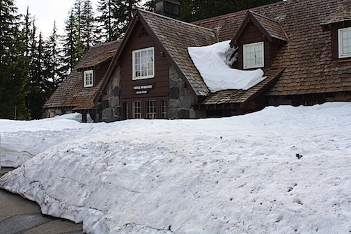
The entrance to the gift shop was so covered with snow, one had to use a snow tunnel to enter at the side of the building. I became very disoriented in the dark until realizing I had left my sunglasses on!
The entrance to the gift shop was so covered with snow, one had to use a snow tunnel to enter at the side of the building. I became very disoriented in the dark until realizing I had left my sunglasses on!
Getting into the gift store was something else. Instead of
walking through the main door, I had to go through a snow tunnel. Most of the
building was covered with at least six feet of snow. The nearby park offices,
on a little higher ground, also required a snow tunnel, as did the only
restaurant that was open.
Another five miles took me to Discovery Point, the open
observation point. I had to scramble up several feet of snow and I was thigh
deep in the wet stuff and beheld the incredible view. I took a number of
photos. It is pretty hard to take a bad one with a view like that. I then went
back to the truck and grabbed Pup to get a photo of him at the lake. Pup is a
great dog. Rescued from Florida, he has the same feelings about snow that I do.
The first time I took him out in the snow, he immediately ran under the trailer
and no amount of coaxing or doggie treats would get him out until he got cold
enough to come to “daddy.” Since then, He’s seen a few snowstorms, but is a
good sport.
As I took him out of the truck, he eyed me with some
suspicion, but he was a good sport about it. I sometimes thing immense things
like the snow all over escape him. I took him on a walk through the California
Redwoods and he would mark his spot on many trees, but the redwoods were so
immense, he couldn’t comprehend they were trees and left them unyellowed.
 Pup just LOVES the snow -- NOT! Taken at Discovery Point, where Crater Lake was first seen by white men.

But he was a good sport about it and climbed up where I had just crushed the snow and posed for his picture. He was obviously happy to get back into the truck.
It was now dinnertime. The restaurant had closed but I was
prepared. Pup had canned food instead of his usual dry food and I mixed some
cold leftover rice with an uncooked can of vegetable soup.
It was now about 6:30 p.m. There were still a couple of
hours of daylight and twilight left and I had to make a decision about where to
spend the night. I wasn’t tired and I decided to “one step” my decision. When
I’m on the road, I often select certain places and decide to stay or move on as
I reach each. I knew for certain that I didn’t want to stay in the truck at
Crater Lake. The temperature was a chilly 39 degrees and I didn’t have anything
warmer than a windbreaker.
I proceeded on.
The landmarks I had chosen were the state park, a Pilot gas
station (they let truckers and RVers park overnight there if you gas up) and
the town of Madras, where we ate lunch.
Although down from the mountains, the temperature at the
state park was in the low 50s at twilight. It was dark when I reached the gas
station, but I was not yet tired. The McDonalds where I had lunch was closed,
as was most of the town and so I continued back to the Gorge. I arrived more
than 13 hours after I left and the trip odometer read exactly 555.5 miles.
I was also
delighted to discover I averaged about 24 mpg. I usually run about 17 mpg when I travel locally. I don’t
want to state the amount when I tow the trailer. It’s too obscene and I was
actually marooned in South Dakota on my way out from the east because the cost
of travel was far higher than waiting a month for my next social security check.
So at 11 p.m., or so, I tried to go to sleep. I gave up and
wrote these 2,300 or so words and sleep finally came around 4 p.m. It was a
good day.